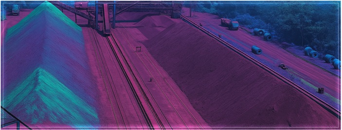
Haul Road Monitoring
Drone or satellite imagery based periodic analysis of detecting areas of wear and tear, traffic flow on Haul Road quickly and accurately and enable doing business sustainably. We use Deep Vision techniques in detecting pothole or other wear tear on road and plan preventive actions; Route Optimization algorithms and advise alternate route for haulage
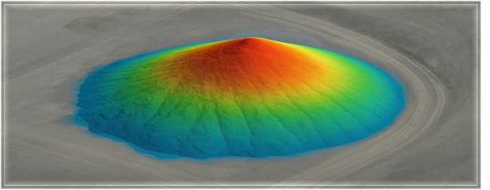
Stockpile Volume Estimation
GeoAI based estimation of stockpile using satellite or drone Imagery captured in regular intervals or near real time . We implement SAR interferometry over Stereopairs which is effective in distinguishing the ore material in precise estimation of volume.
Muckpile Quality Monitoring
Deep vision models applied to hyperspectral and Multi-spectral imagery in detection of mineral composition including moisture contents in regular intervals or near real time – significantly accelerating effective and efficient automated monitoring with precision